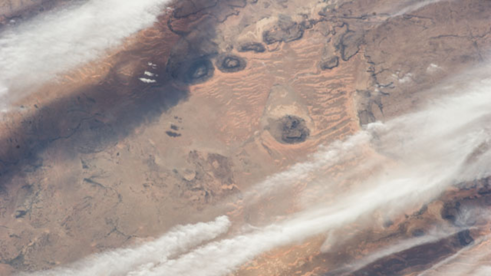
Сансрын станцын одон орон судлаачид Мавританийн өмнөд хэсэгт орших өвөрмөц тогтоц бүхий гурван хар өнгийн тэгш хавтгай уулыг илрүүлэн судалжээ.
Олон улсын сансрын станцаас 2023 оны тавдугаар сарын 3-нд авсан гэрэл зургаар харагдах эдгээр уулс нь Палеозойн эринд хамаарах асар том элсэн чулуун тогтцын үлдэгдэл юм. Олон зуун сая жилийн турш салхи болон усны элэгдлийн улмаас хуваагдсан эдгээр уулсын гадаргуу нь марганец болон төмрийн ислээр баялаг “чулуулгийн лак” (rock varnish)-аар бүрхэгдсэний улмаас хар өнгөтэй харагддаг. Энэхүү нимгэн давхарга нь бичил биетний оролцоотойгоор олон мянган жилийн турш бүрэлдэн тогтдог бөгөөд тухайн бүс нутгийн эртний геологийн түүхийг илтгэдэг байна.
Уулсын байршил нь тус бүс нутгийн элсэн манхны тогтоцыг шууд чиглүүлж байгааг эрдэмтэд онцоллоо. Зүүн хойноос үлээх салхины нөлөөгөөр уулсын зүүн талд хадан ханыг түшсэн “авирагч манхан” (climbing dunes) болон хавирган сар хэлбэртэй “бархан манхнууд” үүссэн бол, баруун талд нь салхины эргүүлгийн улмаас элс тогтох боломжгүй цэвэр гадаргуу үлджээ.
Энэхүү үзэгдэл нь геологийн тогтоц нь орчин үеийн цөлийн гадаргуугийн хэлбэрийг хэрхэн бүрдүүлж буйг харуулах тод жишээ болж байна. Мөн 2014 оны сансрын гэрэл зургуудаар эдгээр уулс нь Сахарын нүд хэмээн алдаршсан Ричат тогтоцтой төстэй гарал үүсэлтэй байж болзошгүй гэх таамаглалыг дэвшүүлжээ.
Дэлгэрэнгүйг эх сурвалжаас харах
↓Эх сурвалжийг нээх ↓
Three flat-topped hills rising between 1,000 and 1,300 feet above the desert floor in southern Mauritania caught an astronaut’s eye, as the International Space Station passed overhead. The photograph, published by NASA’s Earth Observatory, shows a cluster of dark, circular mesas sitting roughly 8 miles northwest of the small town of Guérou, their eastern flanks flanked by rippling tongues of orange sand. To the west, the ground is bare and windswept, entirely free of dunes.
The contrast between the dune-covered east and the barren west is not a coincidence. It comes down to how the mesas interact with the wind, shaping where sand accumulates and where it cannot. Together, the three structures, remnants of a far larger Paleozoic era sandstone formation that broke apart over hundreds of millions of years of erosion, show how deeply ancient geology can still organize the surface of a modern desert.
Rock Varnish Turns Ancient Sandstone Black
The mesas do not look the way sandstone typically does. Instead of tan or ochre, their surfaces are nearly black, a quality that gives them their striking appearance from orbit. According to the NASA Earth Observatory, that color comes from rock varnish, a thin dark coating rich in manganese and iron oxides that builds up on exposed rock surfaces in arid environments over thousands of years.
Rock varnish is not simply a mineral deposit. As reported by to ScienceDirect, it forms through multiple micrometer-thin laminations and was likely partly fixed in place by microorganisms, which help concentrate the manganese at the surface. The process is slow, and the coating accumulates across many millennia, which means the black surfaces visible in the astronaut photograph represent an extremely long history of exposure to the open desert air.
The largest of the three mesas spans approximately 6 miles at its widest point. A fourth mesa sits just north of the trio, visible in a broader astronaut image taken in 2014 but outside the frame of the 2023 photograph. During the Paleozoic era, which ran from roughly 541 million to 251.9 million years ago, all of these structures were likely connected as a single massive formation, as indicated by Live Science. Centuries of water and wind erosion broke it apart into the isolated hills visible today.
Two Types of Dunes, One Rocky Source
The sand dunes visible in the 2023 image are not all the same. The NASA Earth Observatory identifies two distinct types, each produced by a different interaction between the mesas and the wind. The dominant winds blow from the northeast, carrying sand grains toward the western faces of the hills. Where those winds slow against the mesas’ upwind slopes, the grains drop and pile up into what are called climbing dunes, the larger ridge-like accumulations pressed directly against the rock walls.
Farther out from the mesas, smaller dunes form in the open desert downwind. These are barchan dunes, recognizable by their curved, crescent shape. They are more common than climbing dunes and extend as a rippling trail stretching up to 15 kilometers, or about 9 miles, away from the mesas in the upwind direction, according to the Earth Observatory. In the astronaut photograph, the barchan field looks like a flowing tail attached to the eastern side of the rock cluster, its reddish-yellow color contrasting against the darker plain.
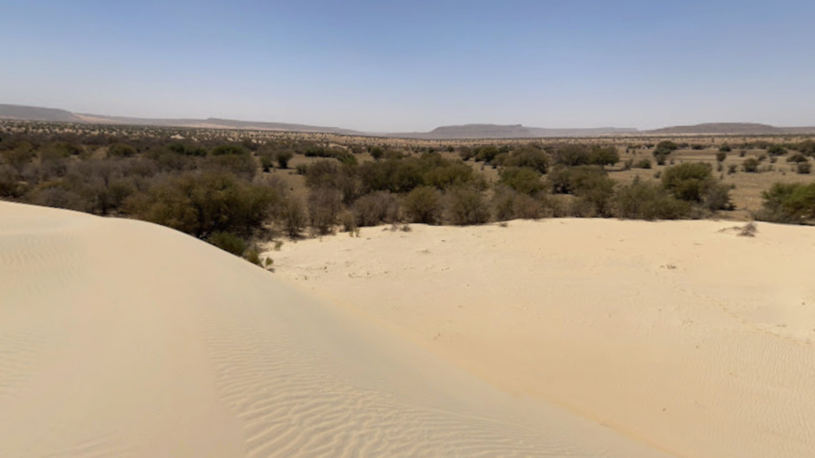
Climbing dunes are comparatively rare. They require a steep, stable surface against which wind-driven sand can build up without dispersing sideways, and the sheer, flat-walled edges of these mesas provide exactly that geometry. The combination of both dune types in one location, each reflecting a different phase of the same wind-and-sand system, makes the site an unusually clear example of how topography directs sediment movement in desert environments.
Wind Scour Keeps the Western Side Clear
The dune-free zone to the west of the mesas is just as telling as the dunes themselves. Sand does not accumulate there because of a phenomenon the NASA Earth Observatory calls wind scour, produced by fast-moving vortices that form as wind is squeezed through the narrow gaps between the mesas. These vortex winds move faster than the surrounding easterly flow, and instead of depositing sand, they strip it away, keeping the ground immediately downwind of the rocks bare.
The effect is visible from orbit. In the 2023 photograph, a barren rocky plain stretches to the west of the mesas with no sand cover, a sharp contrast to the dune-heavy eastern side. The 2014 astronaut image, which captures a wider area of the same desert, shows the pattern extending further, including an additional larger mesa further east and a more expansive barchan field confirming that the dune system stretches well beyond what the 2023 frame shows.
The Mauritanian mesas sit in a part of the Sahara that also contains one of its most iconic geological features. About 285 miles to the north lies the Richat Structure, a massive set of concentric rock rings sometimes called the Eye of the Sahara. Live Science notes that the black mesas’ original Paleozoic formation may have resembled that structure before erosion reduced it to the isolated hills photographed today.
Enjoyed this article? Subscribe to our free newsletter for engaging stories, exclusive content, and the latest news.