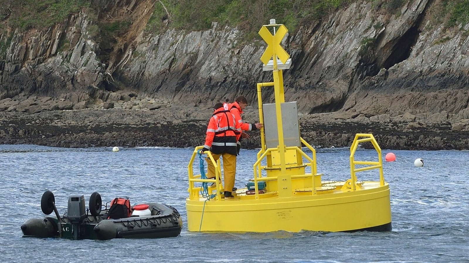
Далайн гадаргын хөдөлгөөн болон давалгааны үзүүлэлтүүдийг хянах зориулалттай тусгай хөвүүрүүд нь далайн аюулгүй байдал, шинжлэх ухааны судалгаа болон тээврийн логистикт чухал үүрэг гүйцэтгэдэг.
Давалгаа хэмжигч хөвүүрүүд нь гироскоп болон хурдатгал хэмжигч зэрэг нарийн багаж хэрэгслээр тоноглогдсон байдаг бөгөөд тэдгээр нь далайн түрлэг, шуурга болон бусад үзэгдлийг бодит цаг хугацаанд хянах боломжийг олгодог. Эдгээр төхөөрөмжөөс ирсэн мэдээлэл нь арилжааны хөлөг онгоцнуудын аюулгүй маршрутыг төлөвлөх, далайн эргийн бүсэд сэлэх болон бусад үйл ажиллагаа явуулахад аюулгүй эсэхийг тодорхойлоход ашиглагддаг. Төхөөрөмжийг уян хатан бэхэлгээгээр суурилуулдаг бөгөөд шаардлагатай тохиолдолд хиймэл дагуул болон радио долгионоор дамжуулан мэдээллийг төвд хүргэдэг.
Тусгай зориулалтын Deep-ocean Assessment and Reporting of Tsunamis (DART) сүлжээний хөвүүрүүд нь далайн ёроолд бэхлэгдэж, цунами үүсэх эрсдэлийг илрүүлэх “цунамиметр” багажийг ашигладаг. Энэхүү мэдээллийг хиймэл дагуулын холбоогоор дамжуулан холбогдох албаныханд шуурхай мэдээлдэг байна. Мөн далайгаас гадна их хэмжээний усны нөөц бүхий нууруудад Real-Time Coastal Observation Network (ReCON) системийг ашиглан усны температур болон хүчилтөрөгчийн түвшинг тогтмол хянадаг.
Австралийн Integrated Marine Observing System (IMOS) зэрэг байгууллагууд 2006 оноос хойш далайн эргийн дагуух хөвүүрийн сүлжээг ашиглан далайн экосистем болон давалгааны шинж чанарыг судалж байна. Цуглуулсан өгөгдөл нь хиймэл дагуулын мэдээллийг тохируулах, цаг агаарын урьдчилсан мэдээг сайжруулах, далайн бохирдлын үед хариу арга хэмжээ авах стратегийг боловсруулахад чухал суурь болдог. Энэхүү технологи нь далайн төлөв байдлын өөрчлөлтийг хянах, байгаль орчныг хамгаалах болон далайн тээврийн аюулгүй байдлыг хангахад зайлшгүй шаардлагатай хэрэгсэл болж байна.
Дэлгэрэнгүйг эх сурвалжаас харах
Эх сурвалжийг нээх ↓
Buoys in the water look quite simple, but what’s so fascinating about them is that they can actually convey a lot of information. From white buoys with blue bands around them to red or green buoys you may see while boating, each has its own purpose.Wave buoys, which aremostly employed to monitor the height, direction, and other parameters of waves on the surface of the water,are used for many different purposes.
Equipped with instruments like gyroscopes and accelerometers, wave buoys are often deployed by researchers to get accurate readings of the world’s oceans.In addition to helping scientists understand currents, storms, and other oceanic features, wave buoys are also used in the commercial shipping industry to help plan the safest routes. They can also help distinguish when or in which areas it is safe to swim by helping monitor the movements of waves.
Wave buoys must be secured or else they will float away, yet they also need to have some flexibility to monitor movement. For this reason, strong yet flexible rubber cord is often used to secure them. That’s not always the case, however. Specialized buoys used by the Deep-ocean Assessment and Reporting of Tsunamis (DART) network called DART Easy To Deploy Buoys, for example, are instead anchored to the ocean floor and use something called a tsunameter to monitor the ocean floor for the development of potential tsunamis. That information is then sent to the authorities through a satellite connection. Let’s take a look at what some other kinds of wave buoys are doing and how they’re helping transform our understanding of our oceans.
Wave buoys can serve a variety of different purposes
Although wave buoys are mostly found in the ocean, they are also found in large freshwater sources like the Great Lakes, where wind power can reach the point of generating waves. There, scientists use a Real-Time Coastal Observation Network (ReCON) buoy to monitor the water’s temperature, oxygen levels, and other factors. This gives an impression of the health of drinking water.Through the Great Lakes Observing System’s Seagull system, anyone can access an interactive map of the area and read the latest data on wave direction, water temperature, and other factors.
Meanwhile in Australia, theIntegrated Marine Observing System(IMOS) consistently uses wave buoys to collect data.A country-wide initiative led by the University of Tasmania, IMOS’purposesince 2006has been to gather information from a range of ocean sources, including a network of moorings around the country’s coast.In addition to tracking marine life, the projectuses wave buoys to determine the heights, strengths, and other characteristics of waves.Technology such as gyroscopes keeps the buoys steady so that they can provide an accurate picture.
This information can be collected in real-time and relayed to scientists through satellite and radio signals. All of this data helps scientists to calibrate satellite information, develop models of wildlife behavior for conservation purposes, predict the weather, and more. By measuring factors like ocean salinity, water vapor, and wave height, scientists can monitor the changing state of the oceans, which can be instrumental in conservation efforts, boating, or developing responses toemerging hazards such as ocean spills.

