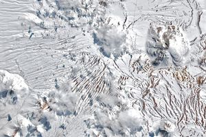
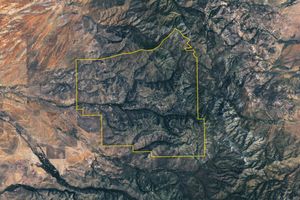
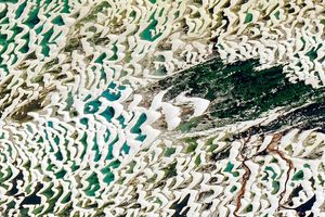
Чилийн хойд хэсгийн Атакамын цөлд тохиолдсон ер бусын их хур тунадасны улмаас газрын хөрсөнд удаан хугацаагаар нойрссон үрүүд соёолж, сансрын эрин үе эхэлснээс хойших хамгийн өргөн хүрээтэй “цэцэглэдэг цөл” буюу desierto florido үзэгдэл ажиглагджээ.
Энэхүү байгалийн ховор үзэгдэл нь Номхон далайн халуун бүсэд Эль Ниньо хүчтэй болсон үетэй давхцсан байна. Эль Ниньогийн нөлөөгөөр бүс нутгийг хуурай байлгадаг субтропикийн өндөр даралт суларч, Өмнөд Америкийн ойролцоо өндөр даралтын бүс тогтсоноор шуурганы зам экватор руу шилжжээ. Долоодугаар сарын дундаас эхлэн агаар мандлын урсгалаар дамжин ирсэн цуврал хүчтэй шуурга Чилийн Атакама мужаас Лос Лагос хүртэлх өргөн уудам нутагт сүүлийн хэдэн арван жилд тохиолдоогүй их хур тунадас авчирсан байна. Наймдугаар сард тохиолдсон өвлийн хүчтэй шуурганы улмаас тус цөлийн зарим хэсэгт ховор тохиолдох цасан бүрхүүл тогтжээ.
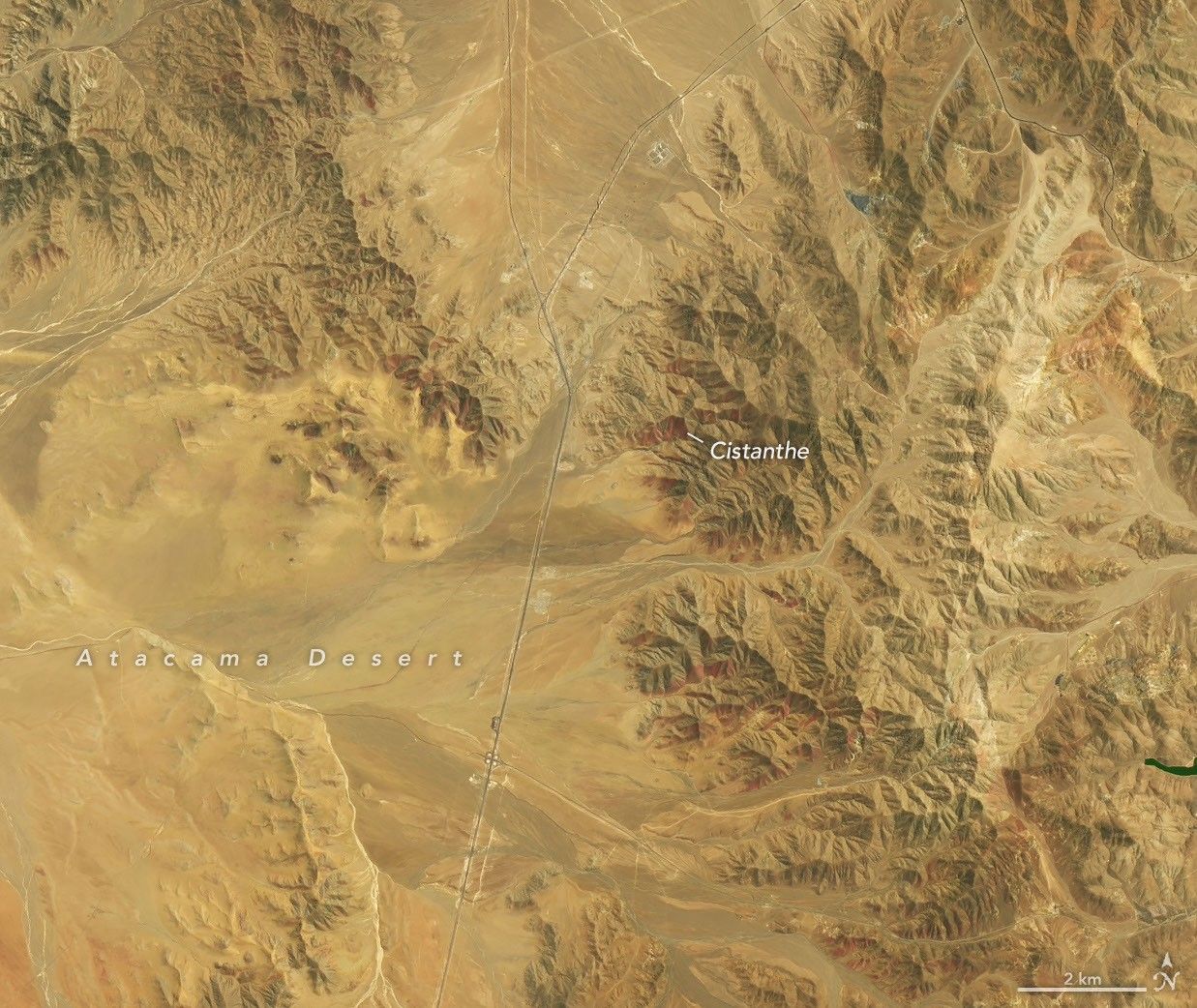
Хөрсний чийгшил нэмэгдсэний үр дүнд есдүгээр сарын 14-нөөс аравдугаар сарын 24-ний хооронд цөл даяар өнгө өнгийн цэцэгс дэлгэрсэн нь Landsat 8 болон Landsat 9 хиймэл дагуулын зураглалаар тод харагдаж байна. Копиапо хотоос баруун өмнө зүгт 30 орчим километр зайд орших “Desierto Florido” үндэсний цэцэрлэгт хүрээлэнгийн ойролцоох улаан ягаан өнгөтэй талбайг “pata de guanaco” буюу Cistanthe төрлийн цэцэгс бүрхсэн бол, бусад хэсэгт Nolana буюу цагаан өнгийн “suspiros” цэцэгс дэлгэрчээ.
Эрдэмтдийн баг хиймэл дагуулын мэдээлэл, дрон болон дижитал камер ашиглан цэцэглэлтийн биологийн олон янз байдлыг судлах төсөл хэрэгжүүлж байна. Энэхүү судалгааны зорилго нь ургамлын тархалт, өөрчлөлтийг нарийвчлан тодорхойлж, газар ашиглалтын төлөвлөлт болон байгаль хамгааллын менежментэд ашиглах явдал юм. Вальпараисогийн Католик их сургуулийн судлаачдын үзэж байгаагаар, 2026 оны энэхүү цэцэглэлт нь хиймэл дагуулын ажиглалт хийж эхэлснээс хойших хамгийн их талбайг хамарсан, хамгийн эрчимтэй бөгөөд удаан үргэлжилсэн тохиолдол болж байна.
Дэлгэрэнгүйг эх сурвалжаас харах
Эх сурвалжийг нээх ↓
September 14
October 24
September 14
October 24
Parts of the Atacama Desert in northern Chile, normally one of the driest places on Earth, turned red-purple, green, and white in austral spring 2026 following an unusually wet winter. The rain woke seeds lying dormant in the soil, setting off what scientists say may be the most extensive desierto florido, or “flowering desert,” of the satellite era.
The rains came as El Niño was strengthening in the tropical Pacific. During an El Niño, the subtropical Pacific high that normally keeps the region dry weakens, while a blocking high tends to form in the South Pacific near the tip of South America. Together, these shifts push the Southern Hemisphere storm track equatorward.
Beginning in mid-July, a series of storm fronts fed by an atmospheric river brought one of the heaviest July rain events in decades to a long stretch of Chile, from the Atacama region south to Los Lagos, according to Chile’s national weather service (Dirección Meteorológica de Chile). In August, back-to-back winter storms blanketed parts of the Atacama Desert in rare snow.
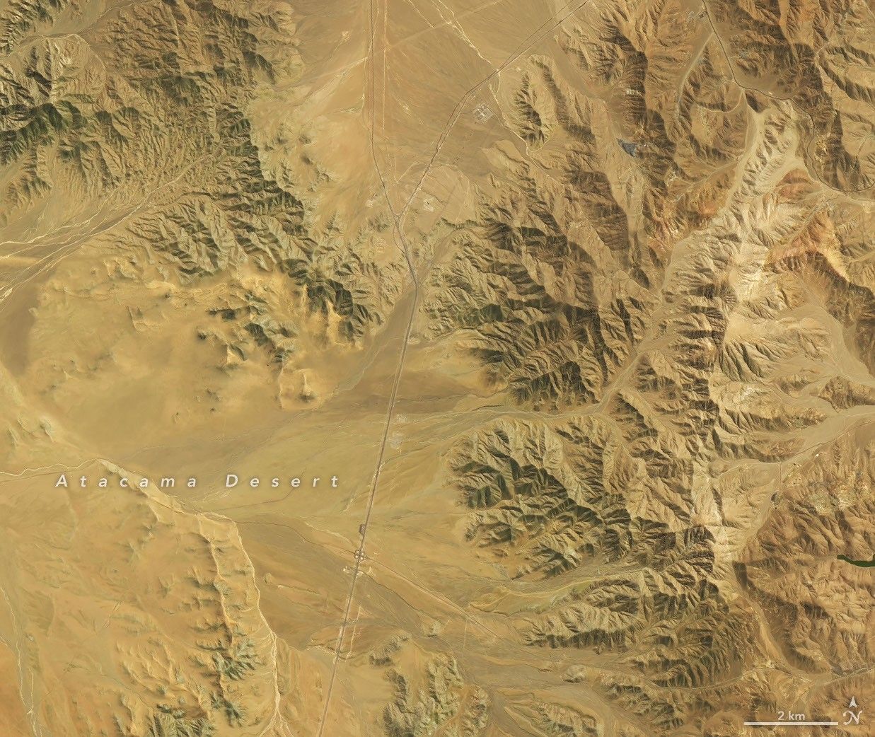
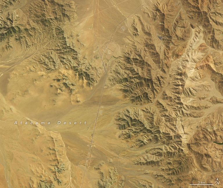
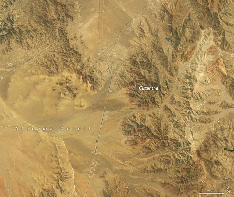
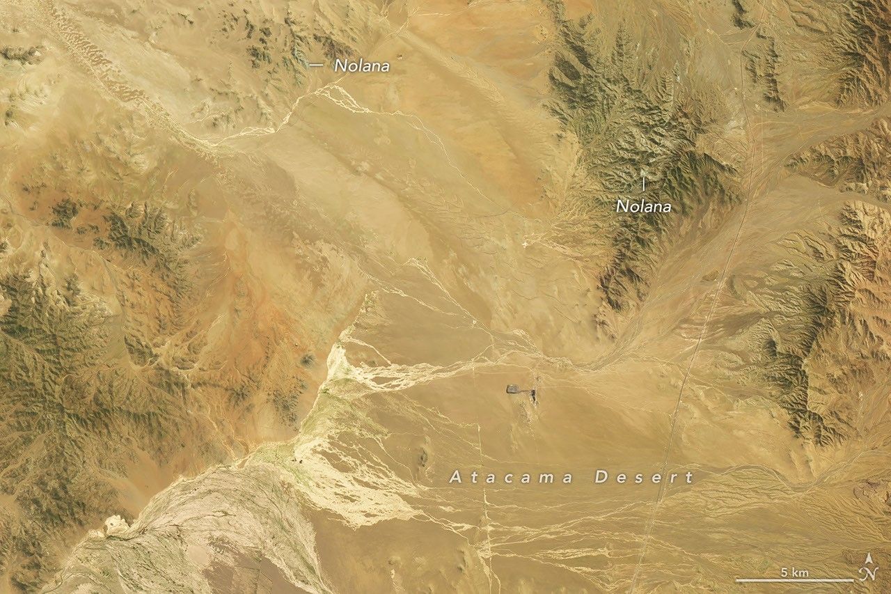
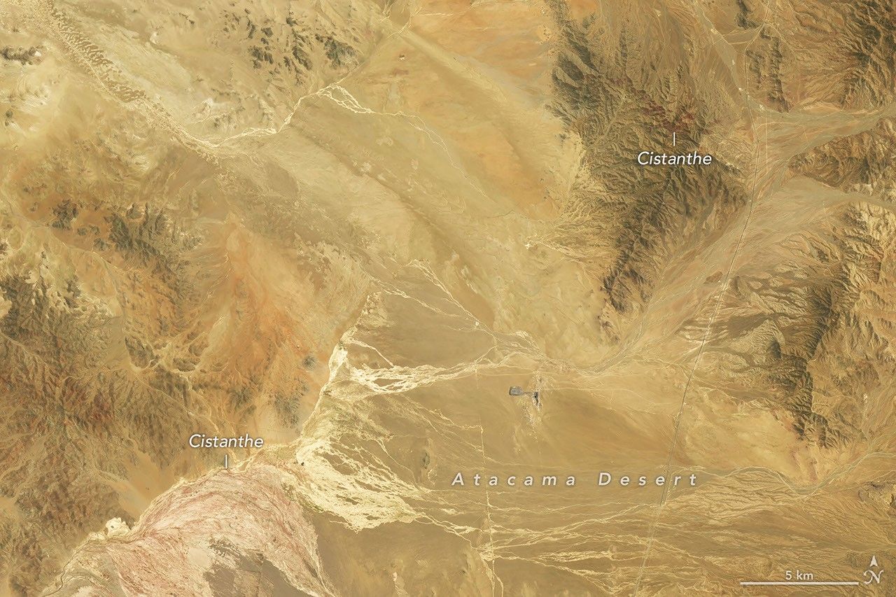
The spring blooms that followed are visible in these satellite image pairs, which show the desert at different stages of flowering on September 14 (left) and on October 24 (right). The OLI (Operational Land Imager) on Landsat 8 acquired the September images, and the OLI on Landsat 9 acquired the October images.
The pair above shows a part of the desert about 30 kilometers (20 miles) southwest of Copiapó, near the eastern sector of Desierto Florido National Park. The red-purple areas prominent in the October 24 scene are vast blooms of pata de guanaco, most likely Cistanthe longiscapa or another Cistanthe species, according to Roberto Chávez, a remote sensing scientist at Pontificia Universidad Católica de Valparaíso.
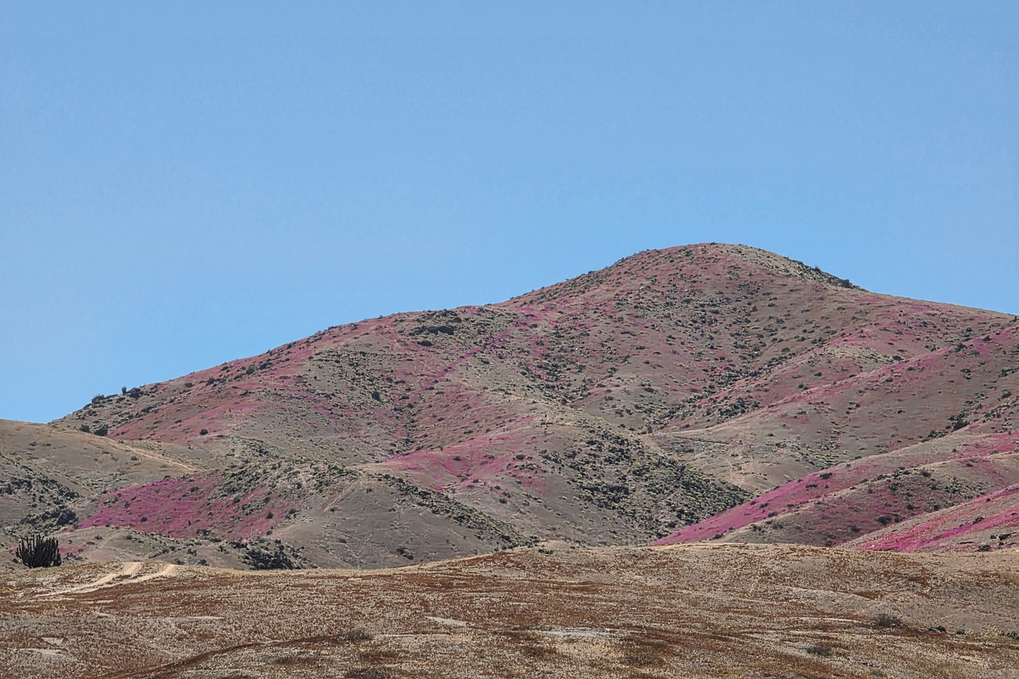
Chávez and colleagues photographed the Cistanthe blooms (above) in the area that same day. They were in the field to study the bloom with satellite data, drones, and digital cameras. The project aims to use these data to map how the bloom’s biodiversity changes across space and over time, to inform land-use planners and conservation managers.
The pair below shows another part of the blooming desert, about 50 kilometers (30 miles) southwest of Copiapó. It lies within a priority area of the desert cited for its biological significance, including the flowering landscape.
september 14
october 24
september 14
october 24
Cistanthe is abundant here in the October view, but the September scene (left) reveals another desert beauty. The green areas capped with white are blooms of suspiros, or Nolana, probablyNolana baccata, according to Andres Moreira-Muñoz, a scientist at Pontificia Universidad Católica de Valparaíso who studies plant geography. The researchers photographed the Nolana-covered hillsides below on September 24, 2026.
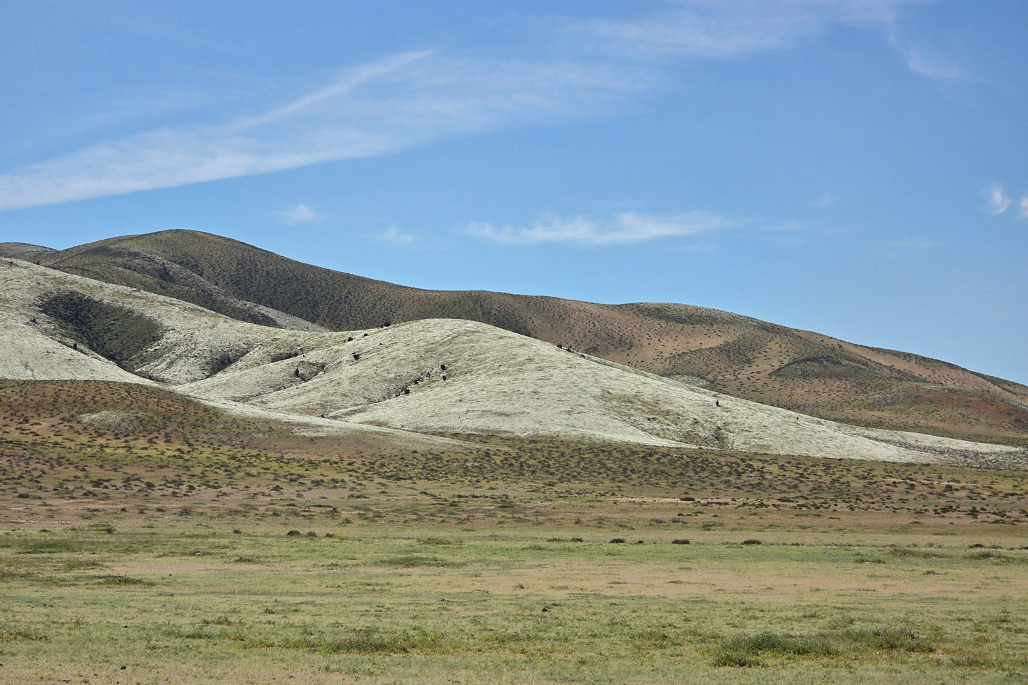
Satellite data have been key to understanding the Atacama’s blooms. A 2014 study used Landsat observations to map where flowering and fog-fed plants grow around the Copiapó dune field. And a 2019 study used NASA’s long-term vegetation record to identify 13 Atacama Desert blooms between 1981 and 2015.
Compared with those past blooms, the 2026 event stands out. “This instance ofthe‘blooming desert’phenomenonappears to bethemost significant to date—in terms of its extent, intensity, and duration,” Moreira-Muñoz said, “at least since we began using remote sensing.”
NASA Earth Observatory images by Michala Garrison, using Landsat data from theU.S. Geological Survey. Photos by Matías Pérez-Evens and Roberto O. Chávez/LabGRS-Instituto de Geografía- Pontificia Universidad Católica de Valparaíso, Chile, acquired during Fondecyt Regular Project 1251184 (ANID, Chile): Spatiotemporal variation of Flowering Desert biodiversity via multispectral remote sensing. Story by Kathryn Hansen.
References & Resources
- Atlas Obscura (2024, May 10) Witness the Stunning and Ephemeral Desierto Florido. Accessed November 18, 2026.
- Biblioteca del Congreso Nacional de Chile/BCN (2023, June 12) Decree 12: Creates the “Flowering Desert National Park,” in the Commune and Province of Copiapó, Atacama Region. Accessed November 18, 2026.
- Castro Avaria, C., et al. (2014) Detección del área con desierto florido en el territorio del Mar de Dunas de Atacama, mediante percepción remota. Revista de geografía Norte Grande, (57), 103-121.
- Chávez, R.O., et al. (2019) GIMMS NDVI time series reveal the extent, duration, and intensity of “blooming desert” events in the hyper-arid Atacama Desert, Northern Chile. International Journal of Applied Earth Observation and Geoinformation, (76), 193-203.
- G5 Noticias (2026, September 29) Flowering Desert 2026: Rains extend the extent of one of the most emblematic natural phenomena of Atacama. Accessed November 18, 2026.
You may also be interested in:
Stay up-to-date with the latest content from NASA as we explore the universe and discover more about our home planet.