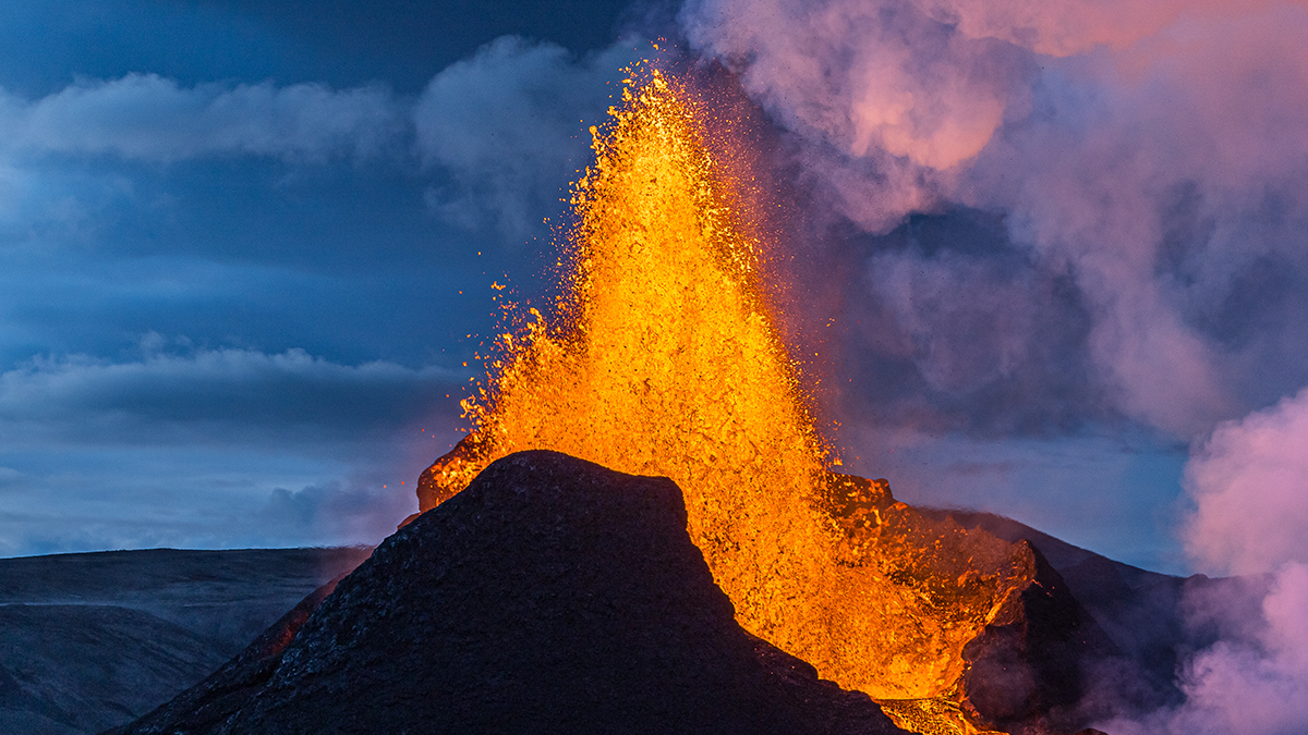
Оксфордын их сургуулийн судлаачид Карибын тэнгисийн идэвхтэй галт уулын гүнд металл агуулсан шингэн давсны уусмал бүхий томоохон бүс байгааг газар хөдлөлтийн өгөгдөлд дүн шинжилгээ хийх замаар тогтоожээ.
Судлаачид Соуфриер Хиллс (Soufrière Hills) галт уулын орчимд 1996-2007 оны хооронд бүртгэгдсэн газар хөдлөлтийн чичирхийллийн P болон S долгионыг судалж, галт уулын дотоод бүтцийн 3D зураглалыг гаргасан байна. Энэхүү судалгаагаар гадаргуугаас хоёр километрийн гүнд, 1-1.5 километр өргөн талбайг эзлэх металл агуулсан давсны уусмалын нөөц байгааг илрүүлжээ.
Галт уулын магмаас ялгардаг халуун, давстай шингэн нь зэс, цайр, хар тугалга зэрэг орчин үеийн технологид нэн шаардлагатай металлуудыг тээвэрлэдэг болохыг эрдэмтэд онцолж байна. Өнөөг хүртэл эдгээр ашигт малтмалыг голчлон эртний унтарсан галт уулын бүсээс олборлодог байсан бол энэхүү аргачлал нь идэвхтэй галт уулын гүнийг өрөмдлөггүйгээр судалж, шинэ орд газрыг нээх боломжийг олгож байна.
Энэхүү нээлт нь зөвхөн металлын нөөц төдийгүй галт уулын геотермаль буюу газрын гүний дулааны эрчим хүчийг ашиглах шинэ гарцыг зааж байна. Гэсэн хэдий ч идэвхтэй галт уулын системээс ашигт малтмал олборлох нь технологийн хувьд эхэн үедээ байгаа бөгөөд цаашид илүү нарийвчилсан судалгаа шаардлагатай юм.
Дэлгэрэнгүйг эх сурвалжаас харах
↓Эх сурвалжийг нээх ↓
Volcanoes can wreak devastation when they erupt, but they’re also a valuable natural resource: the liquids that bubble up from magma are often rich in important metals.
In fact, most mining of metals like copper, zinc, and lead happens on ancient, extinct volcano sites.
As demand for these materials increases – for batteries, computers, and more – active volcanoes could top up existing supplies.
Now, researchers led by a team from the University of Oxford have discovered what they think is a substantial zone of metal-bearing fluids – potentially the beginnings of a new ore – deep in an active volcano in the Caribbean.
Their work mapping the Soufrière Hills volcano has been published in Geophysical Research Letters, and is notable not just for what the team found, but how they found it: using earthquake data.
“Volcanoes are not only sources of geothermal energy but also contain metals needed for modern technologies and the net-zero carbon transition,” write the researchers in their published paper.
“These metals are often carried by hot, salty magmatic fluids a few kilometers beneath the surface, but detecting and studying these hidden reservoirs is challenging.”
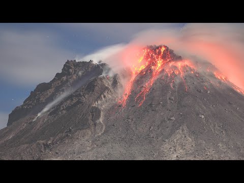
To overcome that challenge, the researchers used seismic wave measurements from earthquakes in the same area that happened from 1996 to 2007, gathered across 23 monitoring stations.
Through a detailed analysis of thousands of faster P-waves and slower S-waves, the researchers were able to construct a 3D map of what’s under the Soufrière Hills volcano, which last erupted in 2013.
As these waves move differently through different materials, the map could distinguish between molten magma and rock filled with liquid.
The team identified a zone around 1-1.5 kilometers (0.62-0.93 miles) across, some 2 kilometers under the surface, holding a “fluid-rich, metal-bearing brine” – a reservoir of metal we may be able to tap into in the future.
“The occurrence of subvolcanic magmatic brines, formed by phase separation of supercritical fluids exsolved from ascending and crystallizing magmas, is of high economic significance as these hypersaline liquids are capable of bearing critical metals,” write the researchers.
More work will be needed to figure out exactly what is in this zone, and at what concentrations, but the study shows that it’s possible to identify areas of potential interest for metal extraction inside volcanoes without any drilling or digging.
The 3D map of the volcano’s plumbing system matched other models from previous studies and is evidence that the wave scanning technique – which suggested the presence of the brine-rich rock – works.
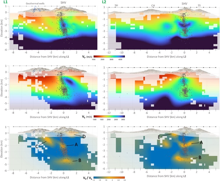
The researchers were also able to identify the location of a solid volcanic core, as well as areas filled with circulating, heated geothermal fluids, and a cap of clay closer to the surface that had been altered by those fluids.
“These findings improve our understanding of how fluids migrate beneath volcanic systems and highlight their potential as sources of both geothermal energy and critical metals,” write the researchers.
“The occurrence of a focused subvolcanic brine lens adjacent to the conduit of Soufrière Hills volcano may play a significant role in the cyclic behavior of the volcano and the types of activity.”
This could be a geothermal energy source as well as a metal ore one, the researchers conclude, though clearly there are risks and difficulties involved in trying to engineer anything out of an active volcano.

There’s the possibility that we’ll eventually be able to extract fluids and metals from these volcanoes without having to wait millions of years for the ores to solidify and become accessible in a conventional way, but the technology is still in its nascent stages.
Now at least we’ve got a better idea of where to look.
Related: There’s a Volcano in Antarctica Spewing Gold Crystals Into The Atmosphere
“Drilling in high-temperature environments, near active volcanoes is challenging, hence geophysical imaging offers an efficient means of examining and detecting the occurrence of brine reservoirs,” write the researchers.
“Our work shows that passive imaging methods can provide images of adequate resolution for imaging such targets, thereby de-risking drilling campaigns.”
The research has been published in Geophysical Research Letters.
This article was fact-checked by Fiona MacDonald and edited by Clare Watson. While we pride ourselves on our process, we are only human. If you spot a mistake, please let us know.